


Geography
https://en.wikipedia.org/wiki/Micronesia#/media/File:Oceania_UN_Geoscheme_-_Map_with_Zones.svg
Micronesia is a region in Oceania that includes approximately 2100 islands, with a total land area of 2,700 km2 (1,000 sq mi), the largest of which is Guam, which covers 582 km2 (225 sq mi). The total ocean area within the perimeter of the islands is 7,400,000 km2 (2,900,000 sq mi).
There are four main island groups in Micronesia:
the Caroline Islands (Federated States of Micronesia and Palau)
the Gilbert Islands (Kiribati)
the Mariana Islands (Northern Mariana Islands and Guam, U.S.)
the Marshall Islands
This does not include the separate island nation of Nauru, along with other distinctly separate islands and smaller island groups.
Caroline Islands
The Caroline Islands are a widely scattered archipelago consisting of about 500 small coral islands, north of New Guinea and east of the Philippines. The Carolines consist of two nations: the Federated States of Micronesia, consisting of approximately 600 islands on the eastern side of the chain with Kosrae being the most eastern; and Palau consisting of 250 islands on the western side.
Gilbert Islands
The Gilbert Islands are a chain of sixteen atolls and coral islands, arranged in an approximate north-to-south line. In a geographical sense, the equator serves as the dividing line between the northern Gilbert Islands and the southern Gilbert Islands. The Republic of Kiribati contains all of the Gilberts, including the island of Tarawa, the site of the country's capital.
Mariana Islands
Mount Marpi in Saipan.
The Mariana Islands are an arc-shaped archipelago made up by the summits of fifteen volcanic mountains. The island chain rose as a result of the western edge of the Pacific Plate moving westward and plunging downward below the Mariana plate, a region that is the most volcanically active convergent plate boundary on Earth. The Marianas were politically divided in 1898, when the United States acquired title to Guam under the Treaty of Paris, 1898, which ended the Spanish–American War. Spain then sold the remaining northerly islands to Germany in 1899. Germany lost all of her colonies at the end of World War I and the Northern Mariana Islands became a League of Nations Mandate, with Japan as the mandatory. After World War II, the islands were transferred into the United NationsTrust Territory System, with the United States as Trustee. In 1976, the Northern Mariana Islands and the United States entered into a covenant of political union under which commonwealth status was granted the Northern Mariana Islands and its residents received United States citizenship.
Marshall Islands
Beach scenery at Laura, Majuro, Marshall Islands
The Marshall Islands are located north of Nauru and Kiribati, east of the Federated States of Micronesia, and south of the U.S. territory of Wake Island. The islands consist of 29 low-lying atolls and five isolated islands,[15] comprising 1,156 individual islands and islets. The atolls and islands form two groups: the Ratak Chain and the Ralik Chain (meaning "sunrise" and "sunset" chains). All the islands in the chain are part of the Republic of the Marshall Islands, a presidentialrepublic in free association with the United States. Having few natural resources, the islands' wealth is based on a service economy, as well as some fishing and agriculture. Of the 29 atolls, 24 are inhabited.
Bikini Atoll is an atoll in the Marshall Islands. There are 23 islands in the Bikini Atoll. The islands of Bokonijien, Aerokojlol and part of Nam were destroyed during nuclear tests that occurred there. The islands are composed of low coral limestone and sand. The average elevation is only about 2.1 metres (7 ft) above low tide level.
Nauru
Nauruis an oval-shaped island country in the southwestern Pacific Ocean, 42 km (26 mi) south of the Equator, listed as the world's smallest republic, covering just 21 km2 (8 sq mi).With 12,511 residents, it is the third least-populated country, after Vatican City and Tuvalu. The island is surrounded by a coral reef, which is exposed at low tide and dotted with pinnacles. The presence of the reef has prevented the establishment of a seaport, although channels in the reef allow small boats access to the island. A fertile coastal strip 150 to 300 m (490 to 980 ft) wide lies inland from the beach.
Wake Island
Wake Island is a coral atoll with a coastline of 19 km (12 mi) just north of the Marshall Islands. It is an unorganized, unincorporated territory of the United States. Access to the island is restricted and all activities on the island are managed by the United States Air Force. While geographically adjacent, it is not ethnoculturally part of Micronesia, due to its historical lack of human inhabitation. Micronesians may have possibly visited Wake Island in prehistoric times to harvest fish, but there is nothing to suggest any kind of settlement.
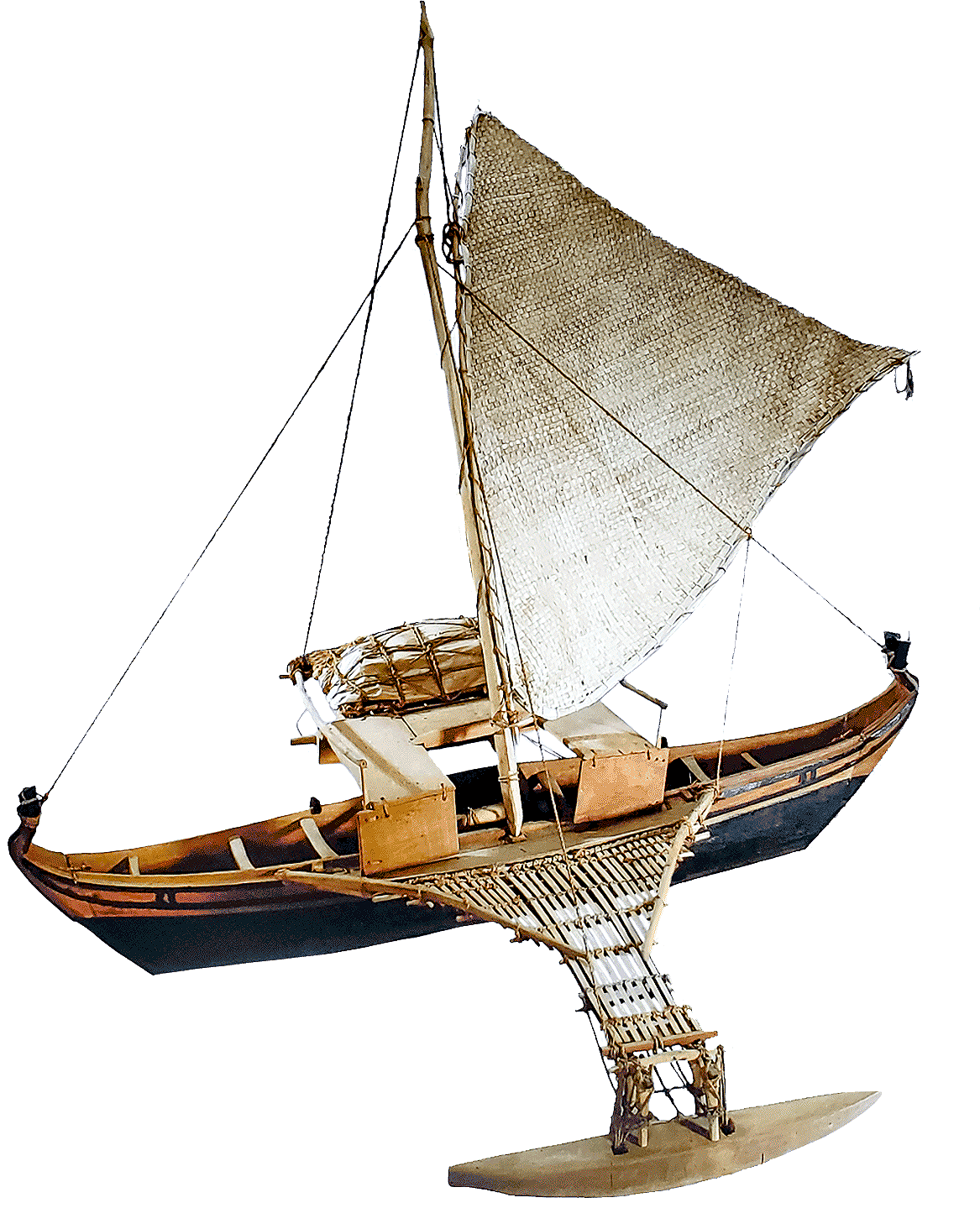
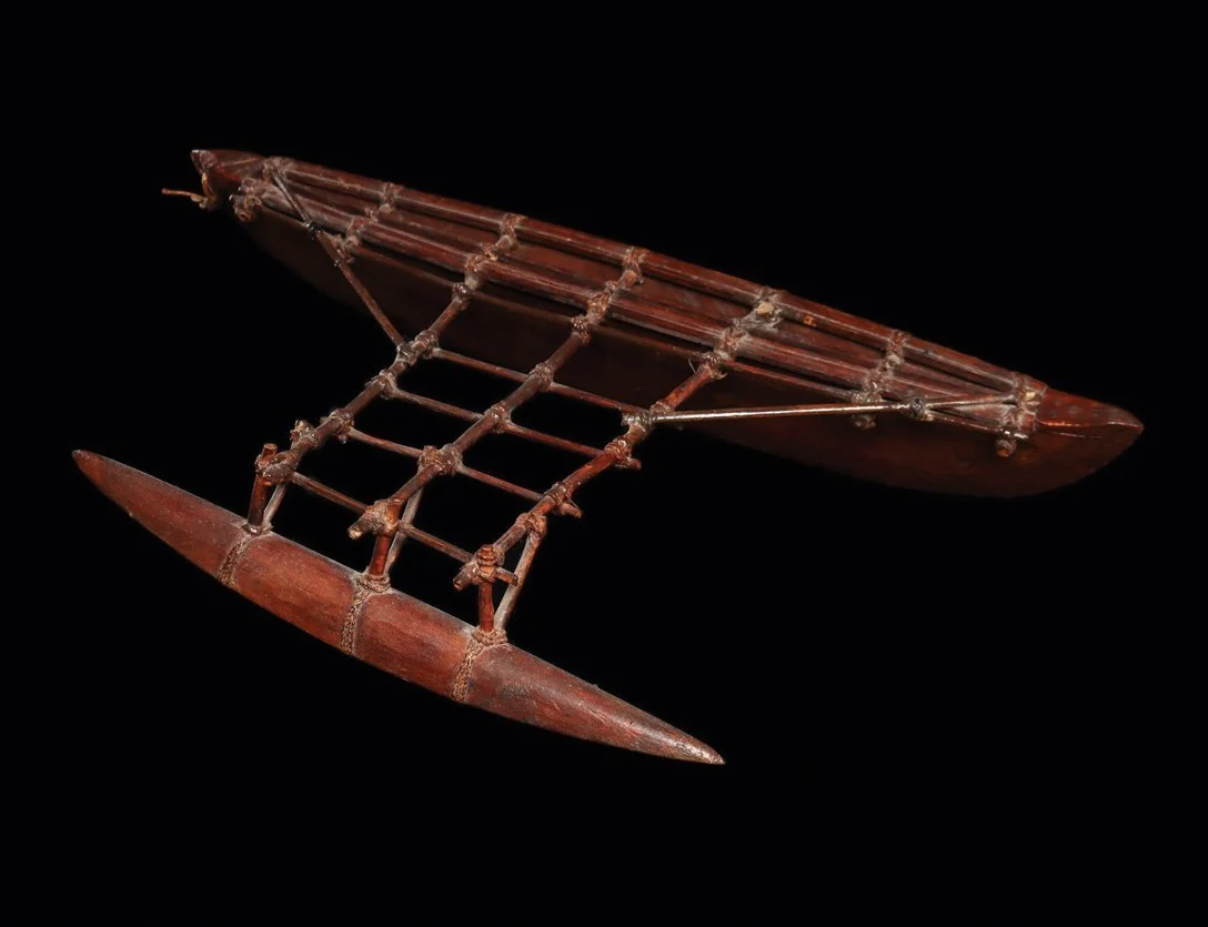
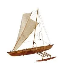
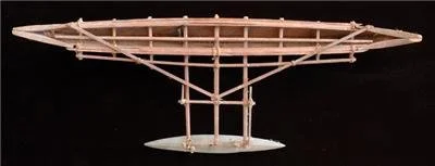
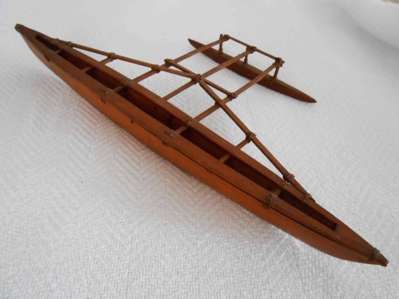
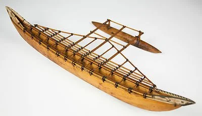
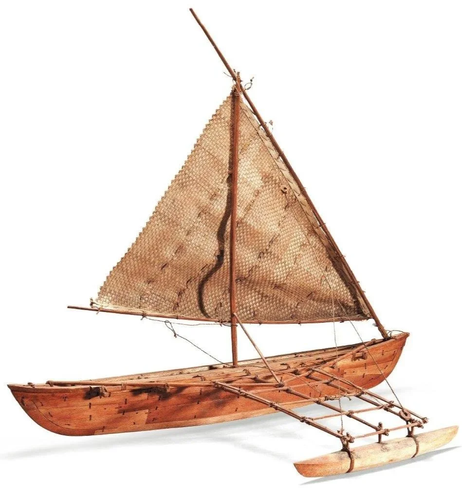
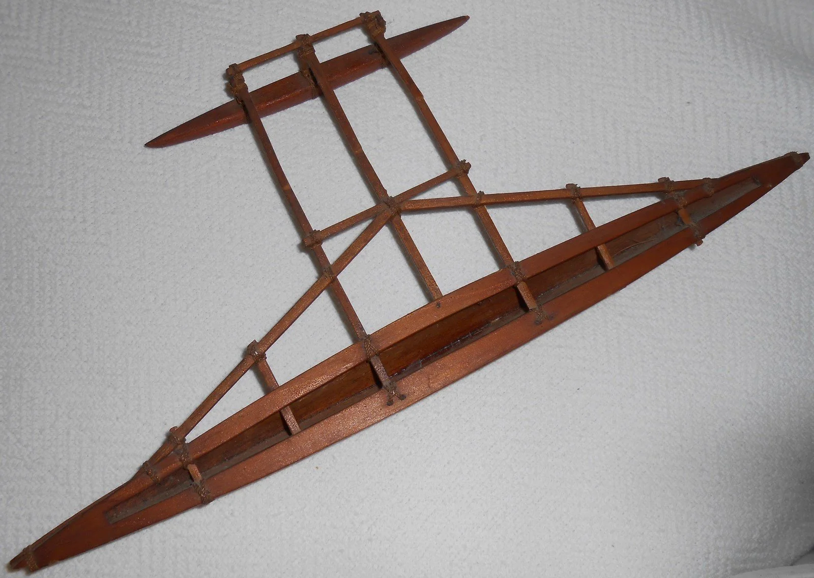
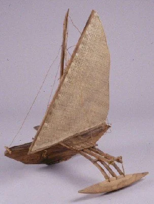
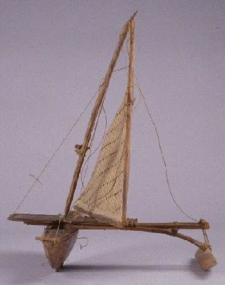
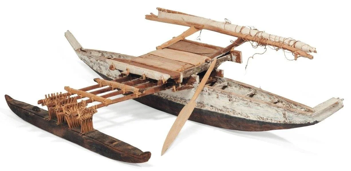
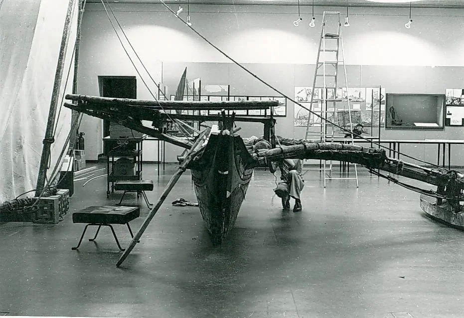
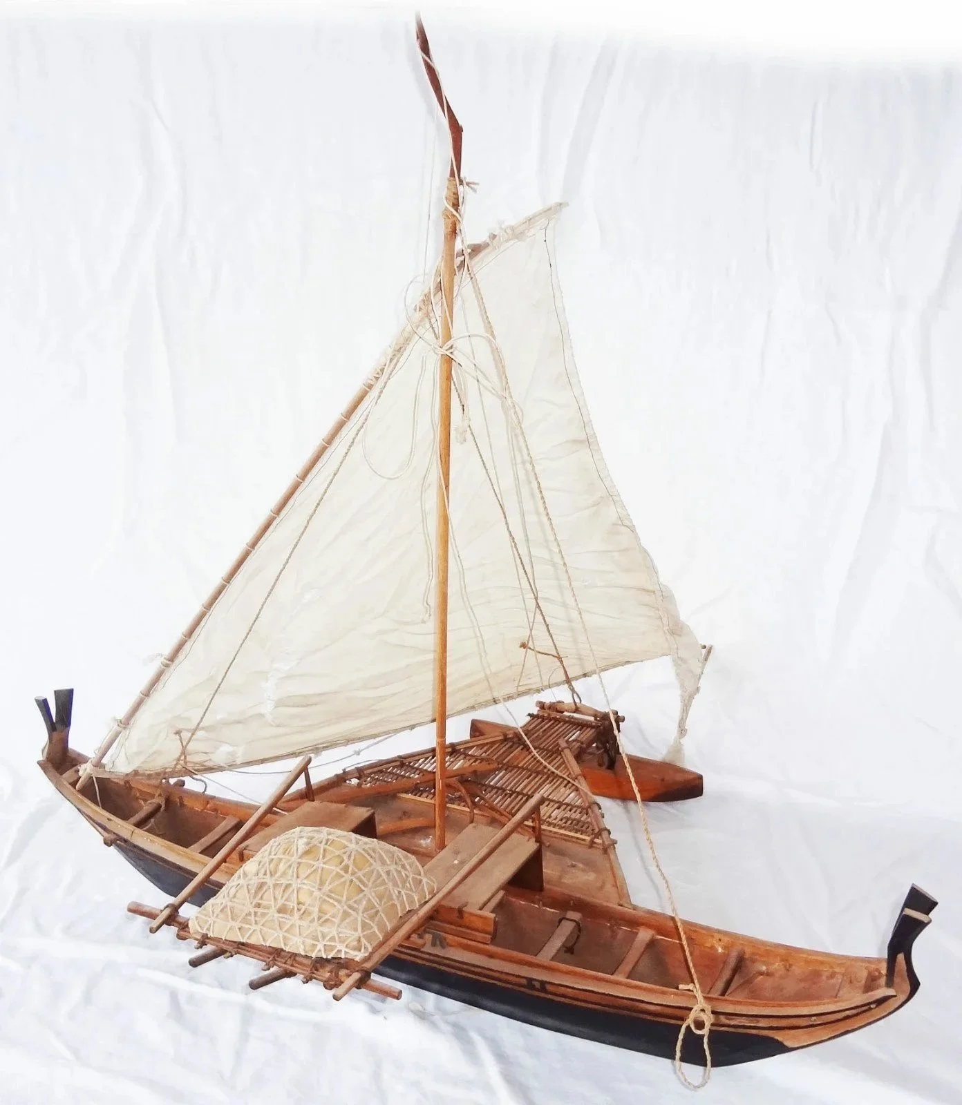
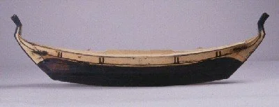
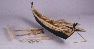
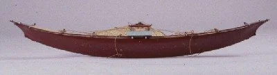
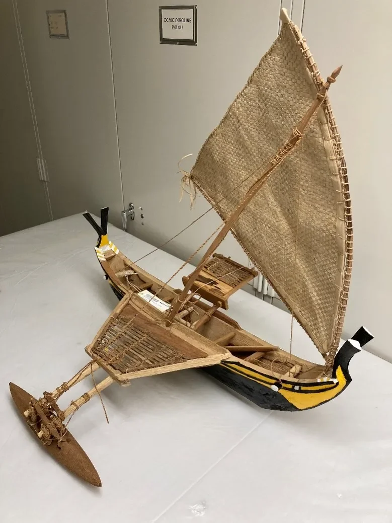
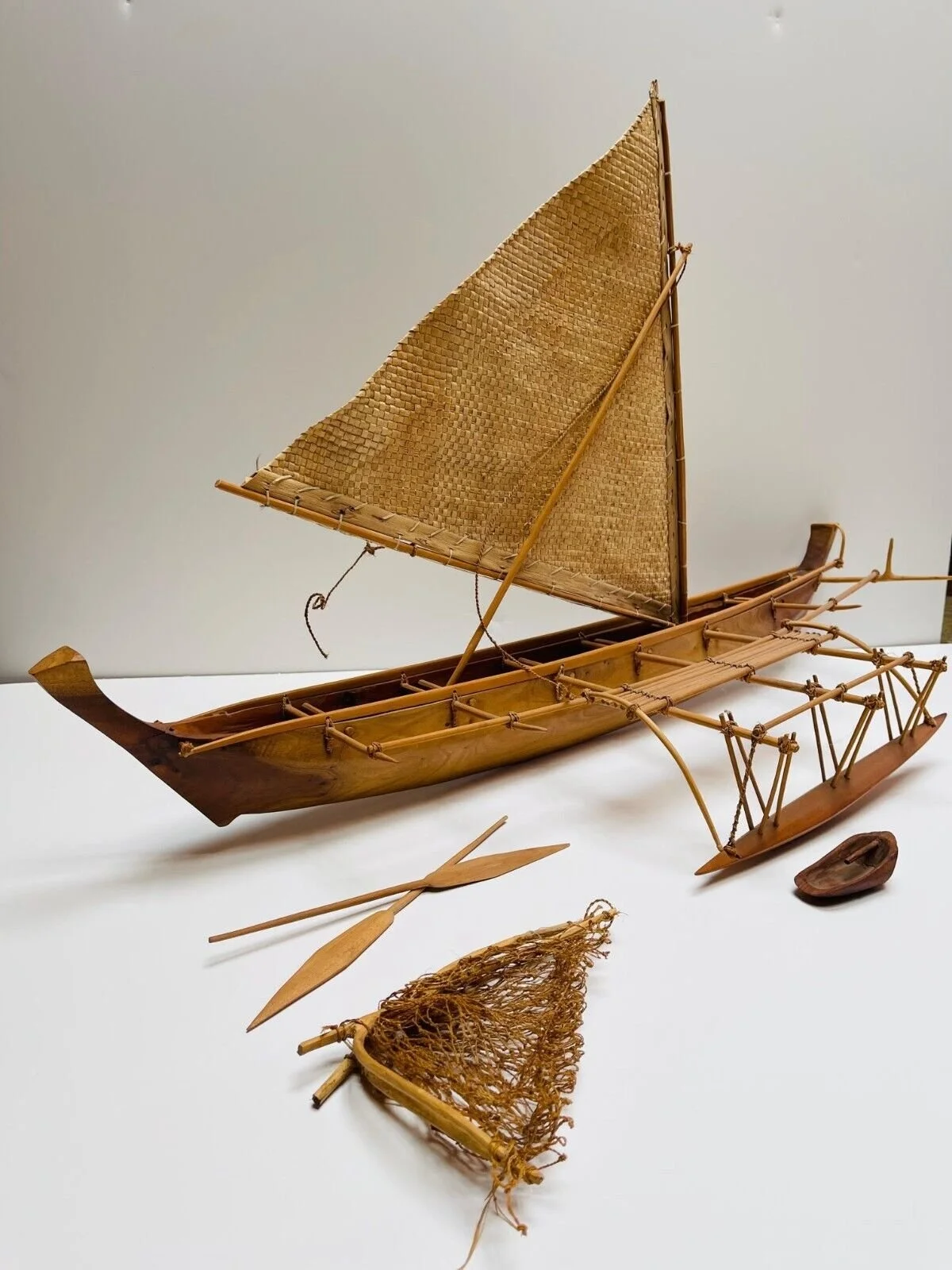
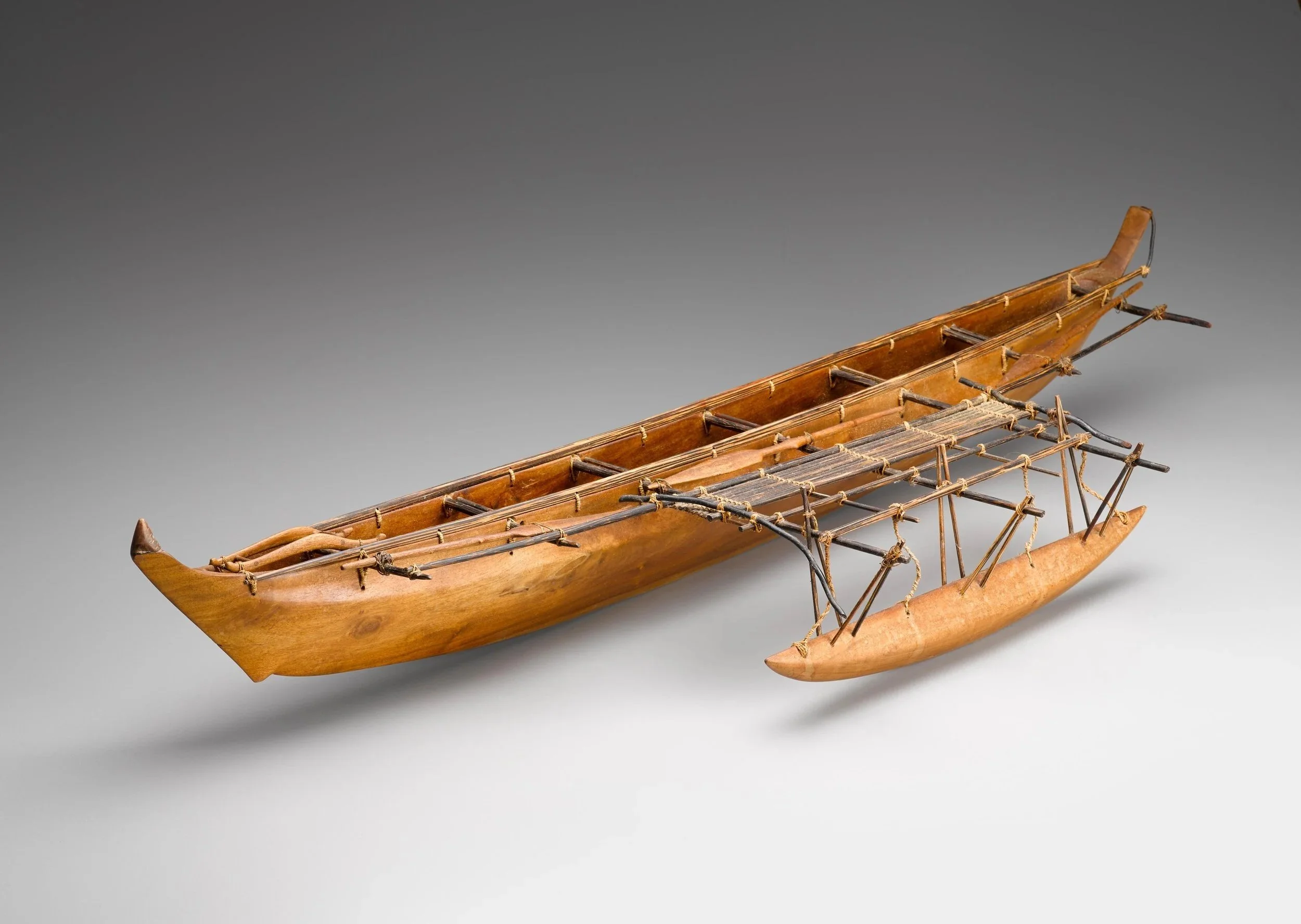
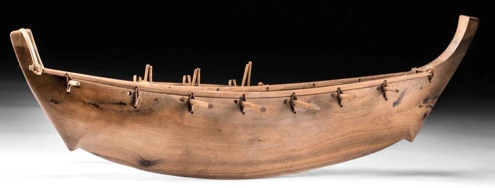
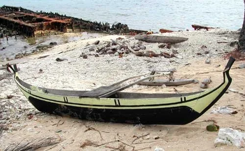
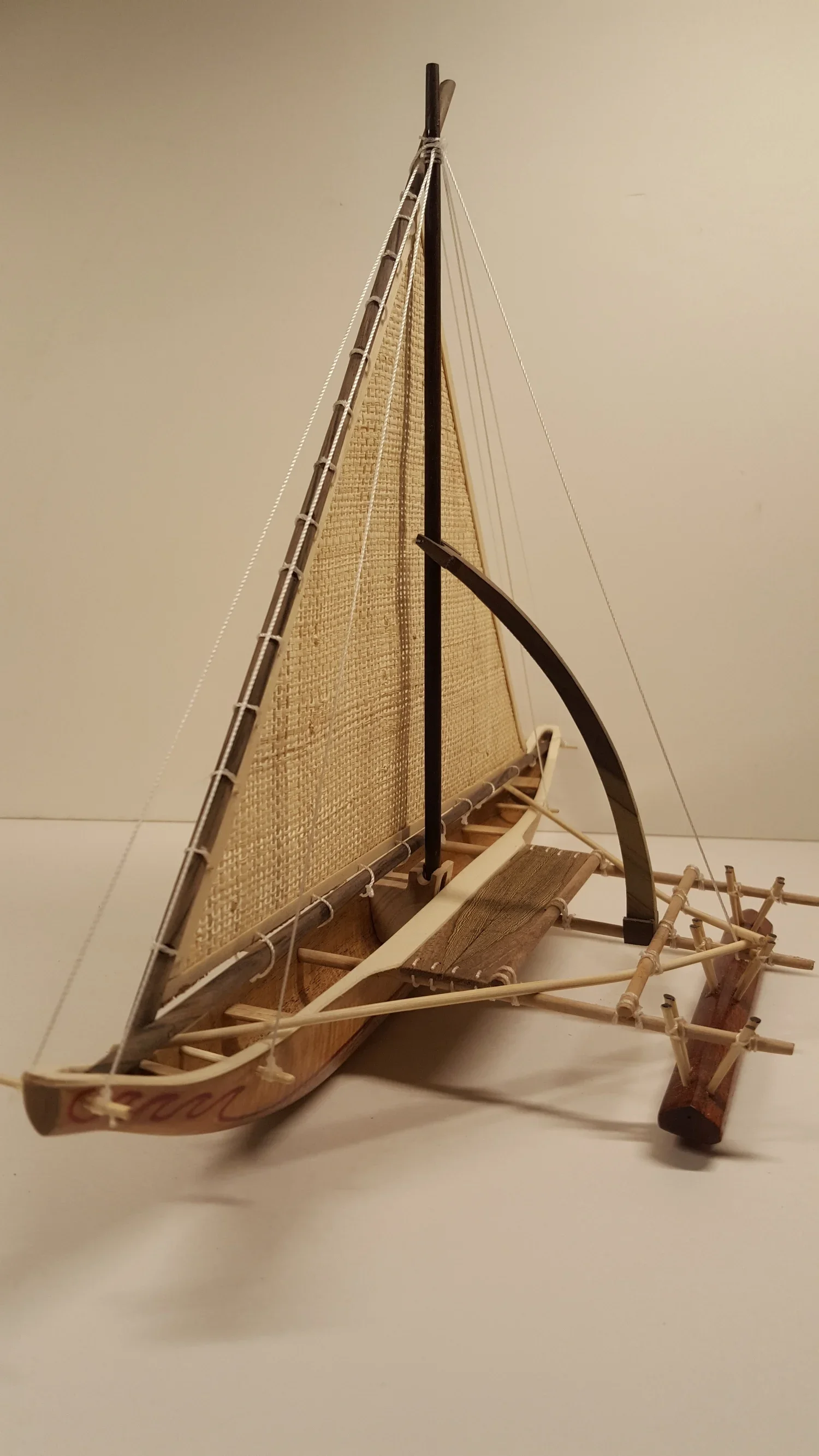
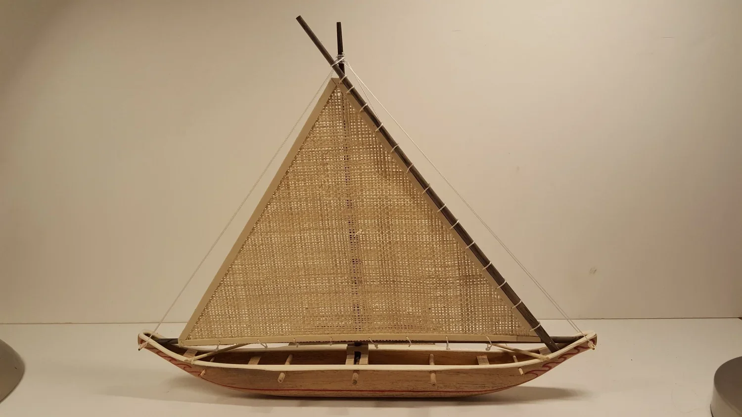
CAROLINE ISLANDS
I chose to illustrate this flying proa as it is representative of the Micronesian canoes. This model shows a type of canoe that used to be built on Yap island but still are on Santawal atoll.
Santawal is located in the Caroline Islands (part of the Federated States of Micronesia). The atoll is recognized for its continued practice of traditional navigation techniques, including the construction of ocean-going canoes.
While modern materials are also used in canoe construction, the spirit of traditional canoe building and its significance in cultural preservation continue in Satawal.
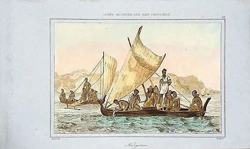
KIRIBATI, formerly the Gilbert islands
Canoe model 19C
KIRIBATI formerly GILBERT ISLANDS
Canoe model representing the type of vessel built on the island of Abemama and Tarawa.
GILBERT ISLANDS
Model canoe
GILBERT ISLANDS
Top view of the model canoe
GILBERT ISLANDS
Model canoe
GILBERT ISLANDS
Model canoe
GILBERT ISLANDS
Model Canoe 19 C
GILBERT ISLANDS
Showing bow of previous model
GILBERT ISLANDS
Canoe model
GILBERT ISLANDS
Line drawings of a Gilbert Islands canoe by Alamy
KIRIBATI, formerly Gilbert Islands
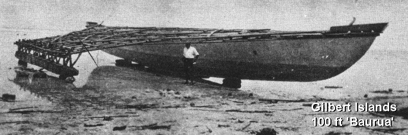
GILBERT ISLANDS
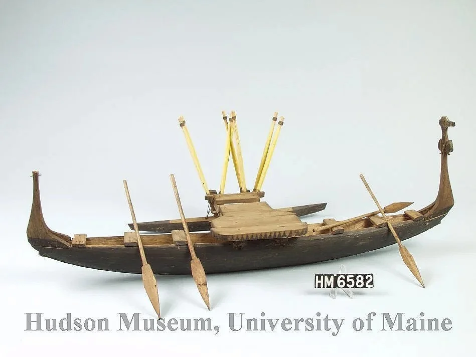
This type of canoe, called “Baurua” were the biggest and longest single hull canoe built on those islands. The “Baurua” could attain a length of 100 fr or 23 meters. They could transport up to 30 people.
Those vessels were mostly built on the Island of Nonuti and Tabiteuea.
Kiribati island 2.jpg
GILBERT ISLANDS
Model canoe
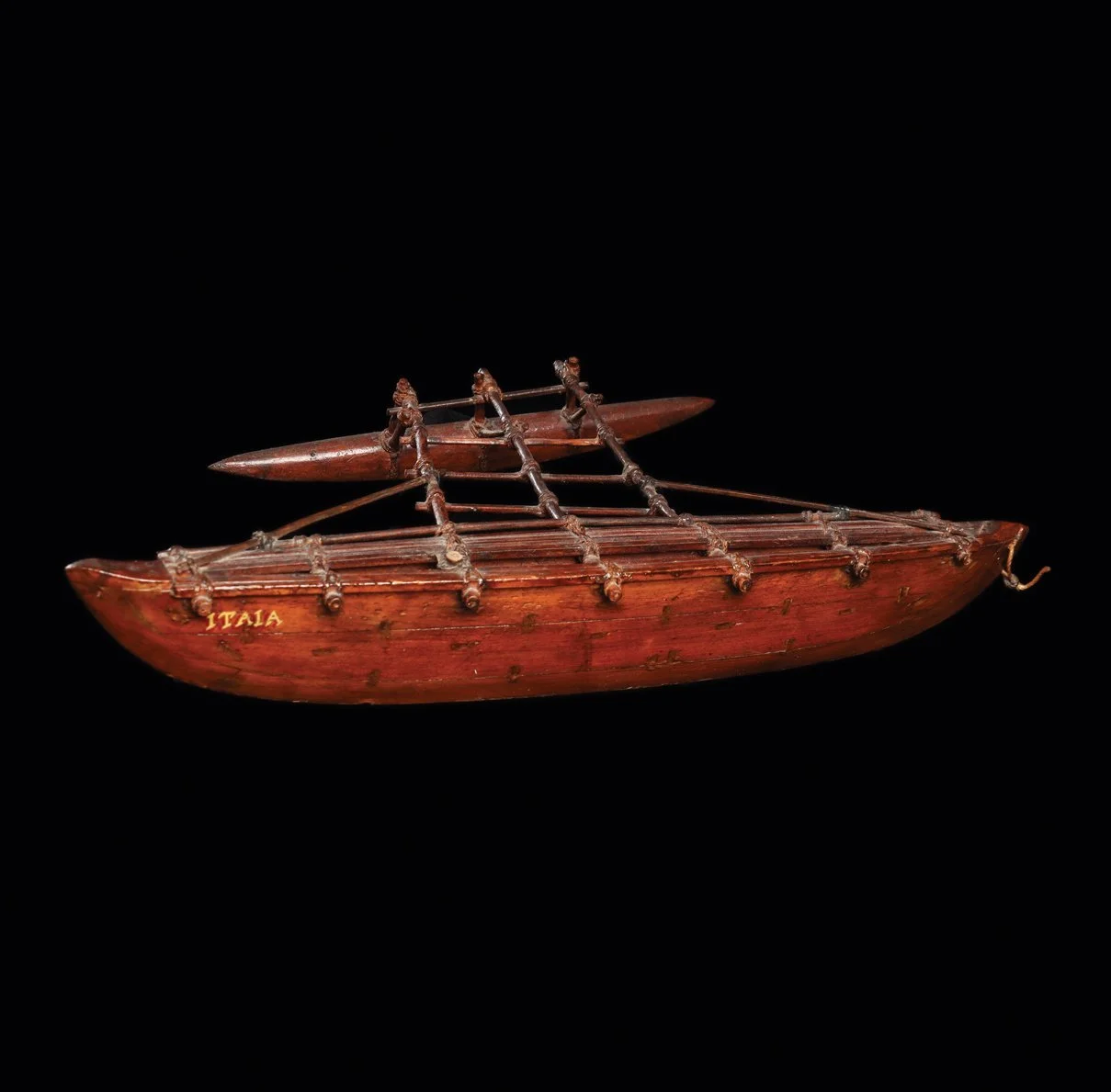
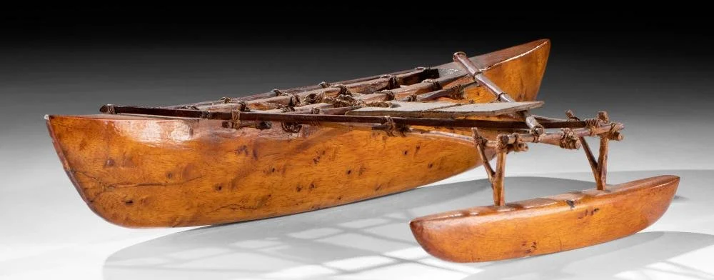
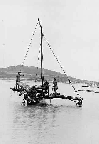
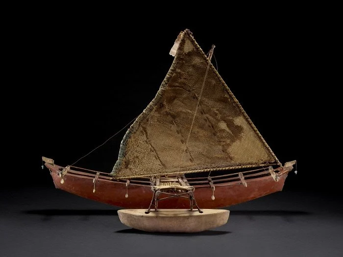
MARSHALL ISLANDS
Kwajalein Atoll , Talik Chain, model canoe,
MARSHALL ISLANDS
Ralik Chain model canoe
Marshall island, questionable
The horizontal beams would indicate that it is not a Marshallese canoe.
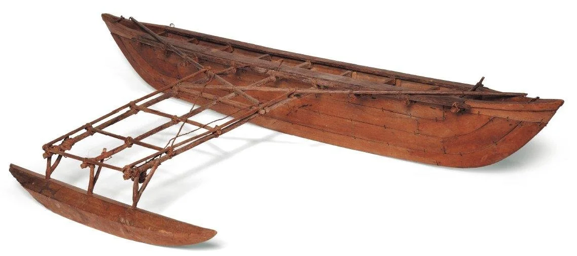
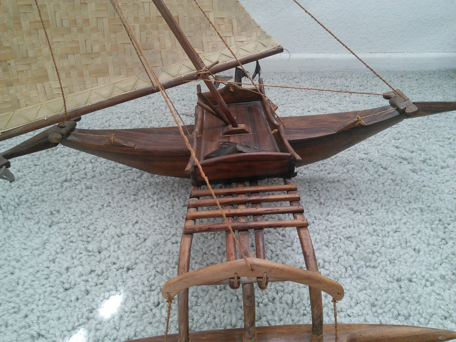
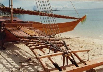
MARSHALL ISLANDS
Walap model
Marshall Island
Walap model
Marshall Islands
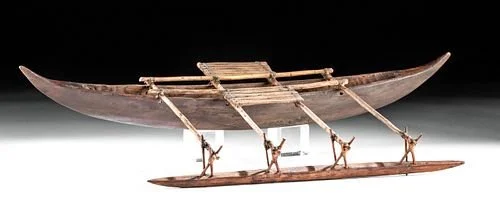
MARSHALL ISLANDS
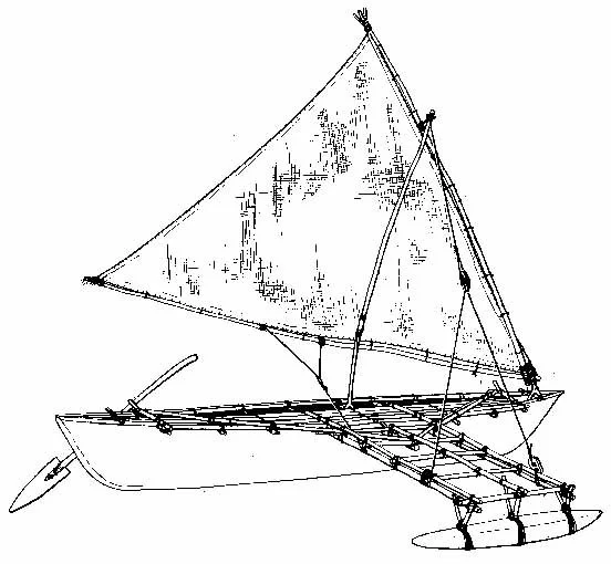
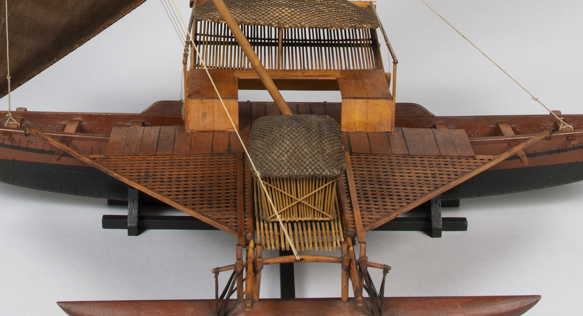
A Jaluit sailing canoe, also called “Wa lap” showing all essential features of the design used in the Marshall Islands.
For more information about Marshallese canoes visit:
https://marshall.csu.edu.au/Marshalls/html/essays/es-tmc-1.html
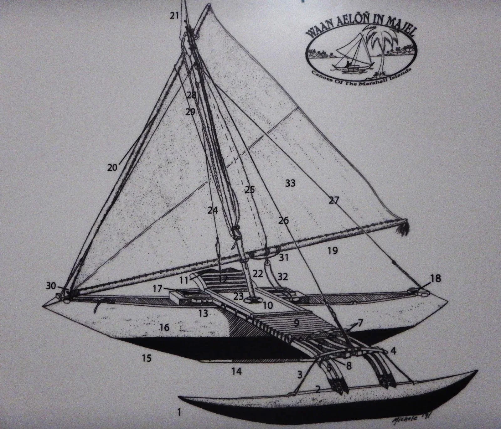
MARSHALL ISLANDS
Names of canoe parts by Karen Earnshaw
https://www.canoesmarshallislands.com/2014/09/names-of-canoe-parts/
Marshall Islands Majuro1.jpg
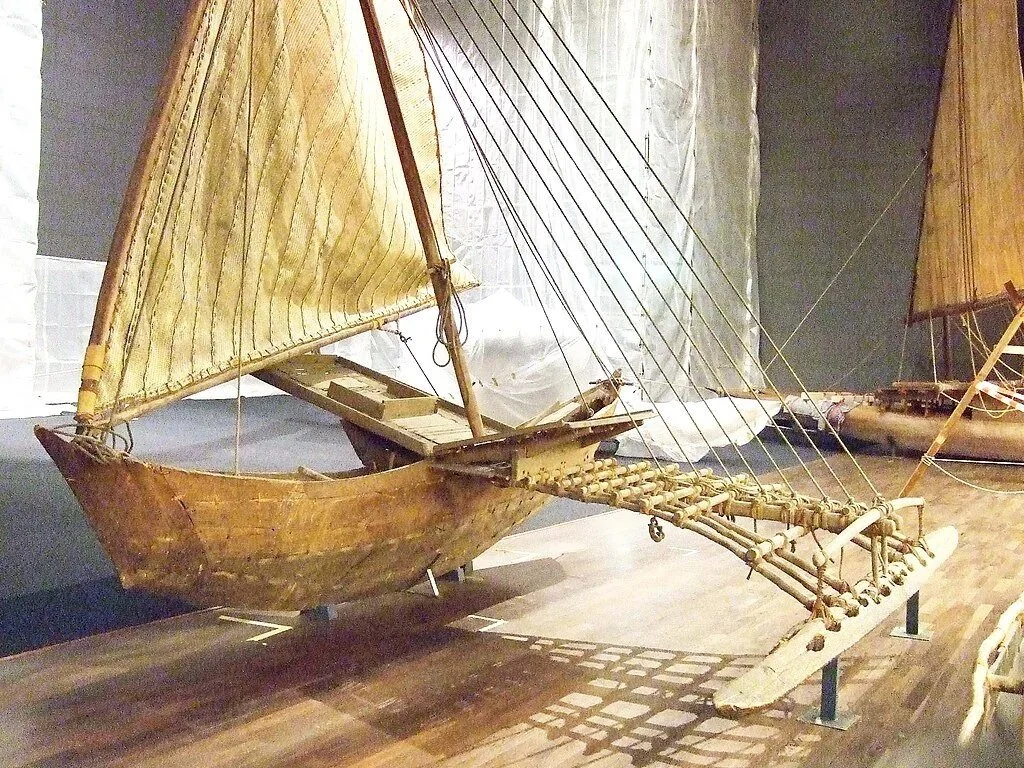
MARSHALL ISLANDS
A Walap from Jaluit atoll, 1880.
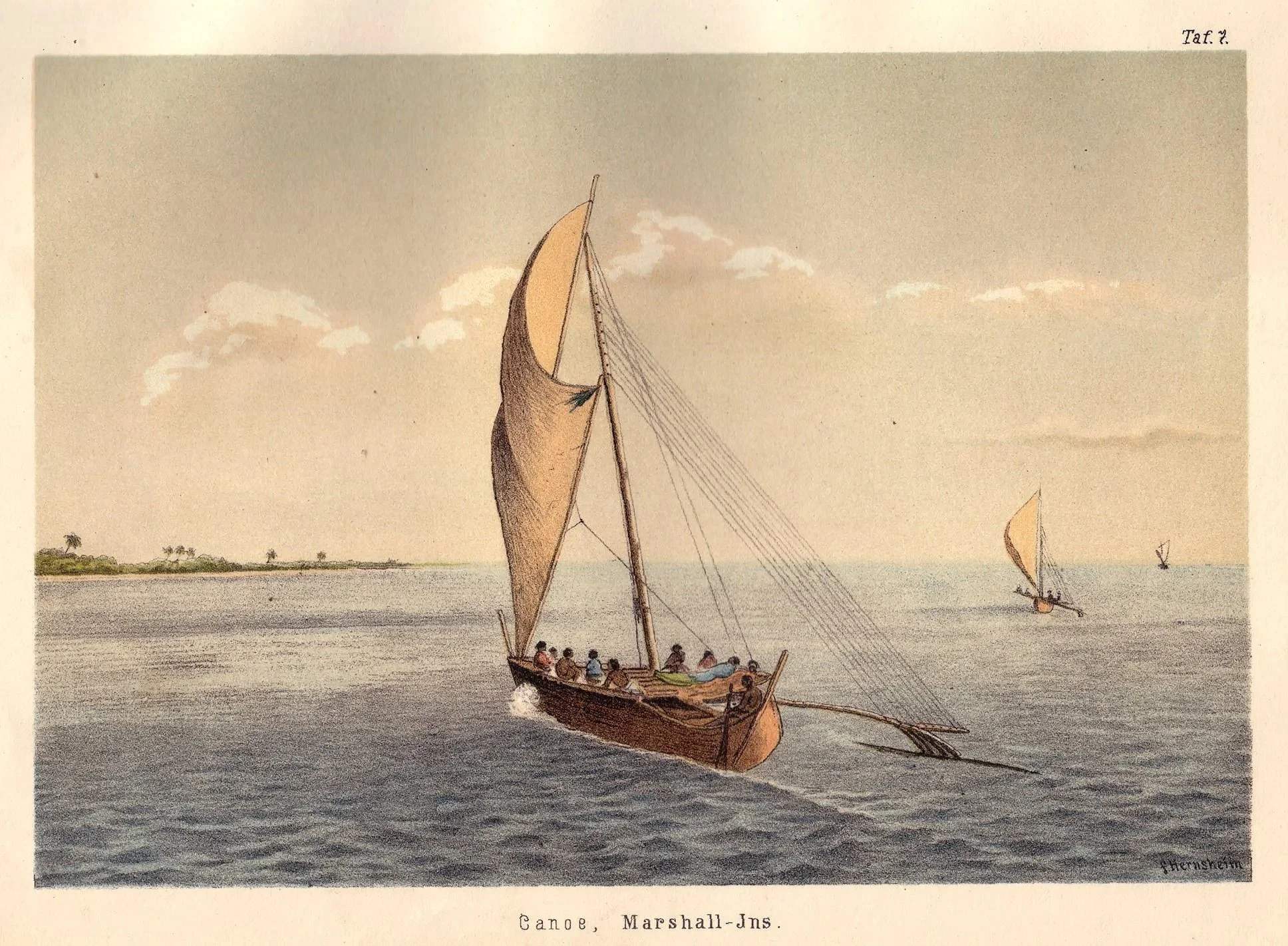
MARSHALL ISLANDS
Image extracted from page 133 of Suedsee Erinnerungen (1875-1880) with a preamble by HERNSHEIM. British Library
MARSHALL ISLANDS
Model of a Marshallese walap, 1891. Staatlichen Museums fuer Voelkerkunde, Munich, Germany
MARSHALL ISLANDS
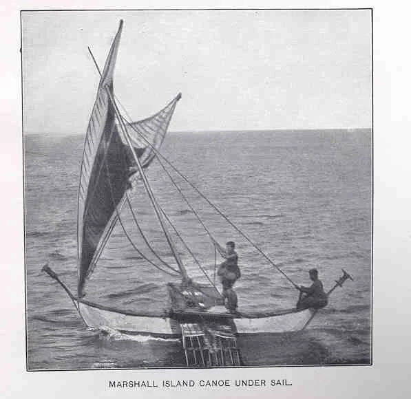
Marshall island canoe under sail
MARSHALL ISLANDS
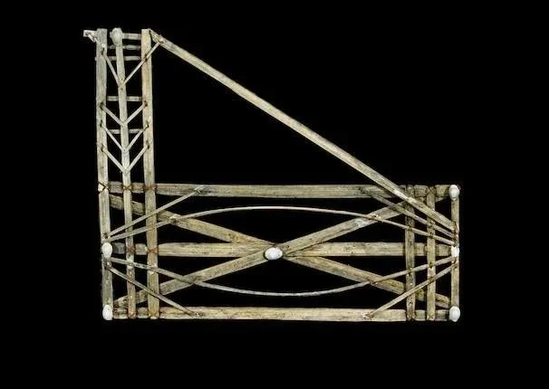
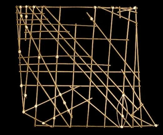
Navigational chart, Marshall Islands. It is worth mentioning the work by Captain Winkler at this point on his work: “On Sea Charts formerly used in the Marshall Islands, with Notices on the Navigation of These Islanders in General“, 1899, describing the unique Marshallese stick charts, which documented wave and swell patterns to aid in seafaring between the low-lying islands of the Marshall Islands in eastern Micronesia. These complex, non-portable charts used sticks to represent wave paths and shells to mark island locations, providing a system of navigation that relied on interpreting oceanographic data rather than simply mapping landmasses.
MARSHALL ISLANDS
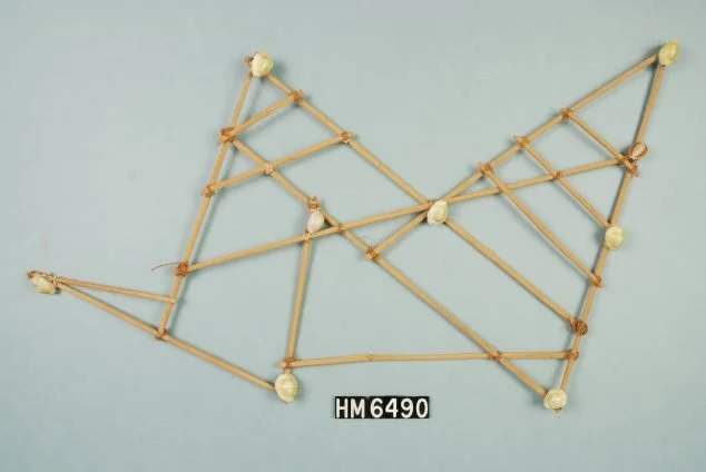
Navigational chart. Hudson Museum
MARSHALL ISLANDS
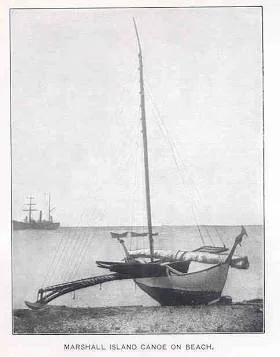
Old photo showing a walap on the beach
MARSHALL ISLANDS /Majuro atoll
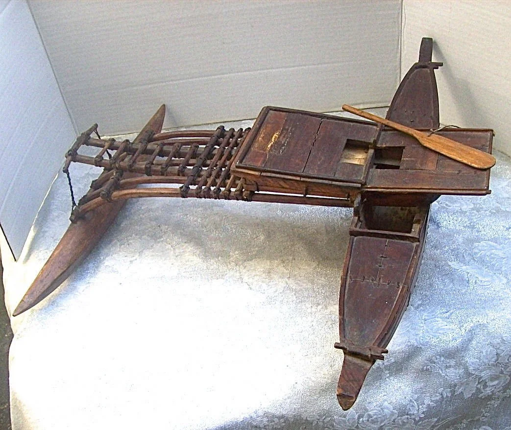
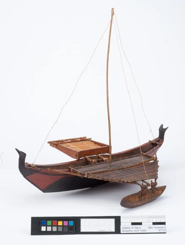
20th C CAROLINE ISLANDS ?
A 20th C model of a Palau canoe ?
CAROLINE ISLANDS
A Mokil outrigger canoe, side view (courtesy of Hamburg Museum fuer Voelkerkunde)
Mokil is a small reef about 90 miles eastward of Ponape. It was discovered in 1824 by Duperrey.
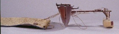
CAROLINE ISLANDS
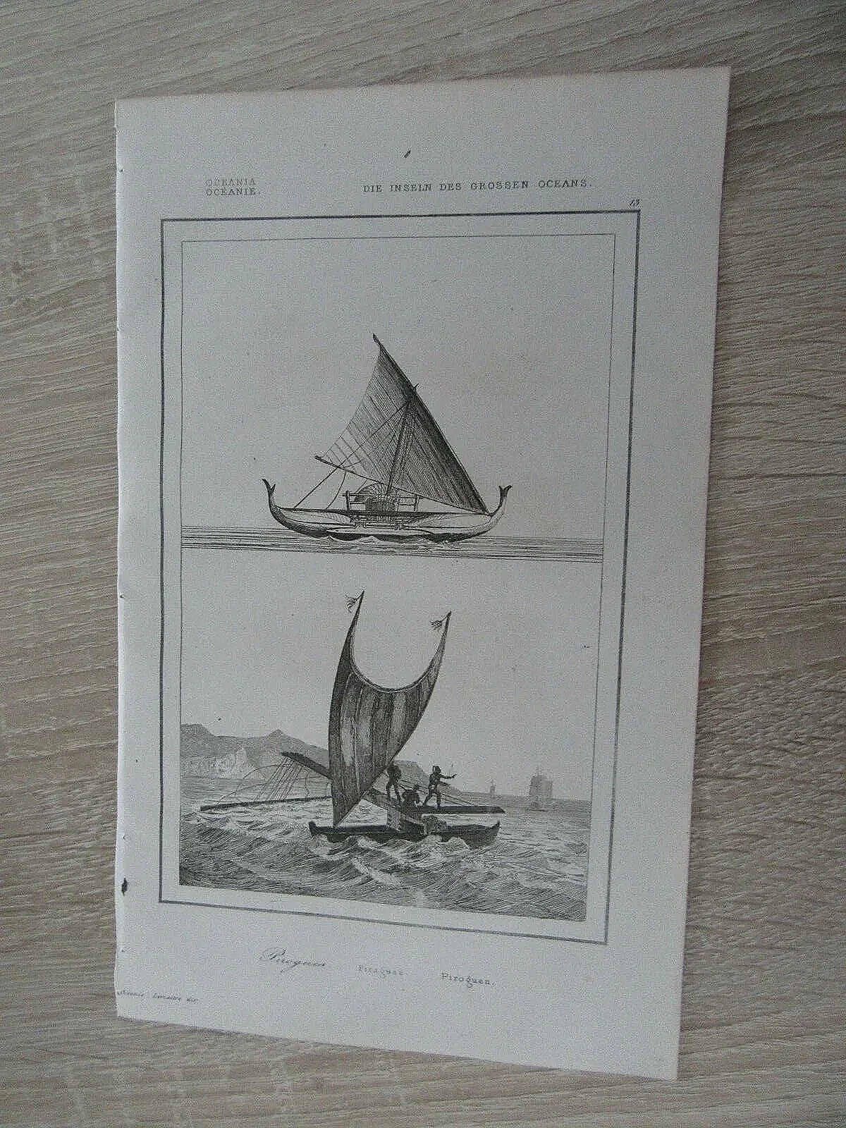
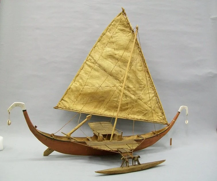
Proa of Satawal, 1833, by Francois-Edmond Paris
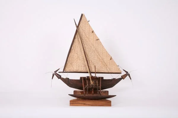
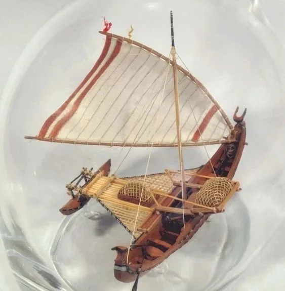
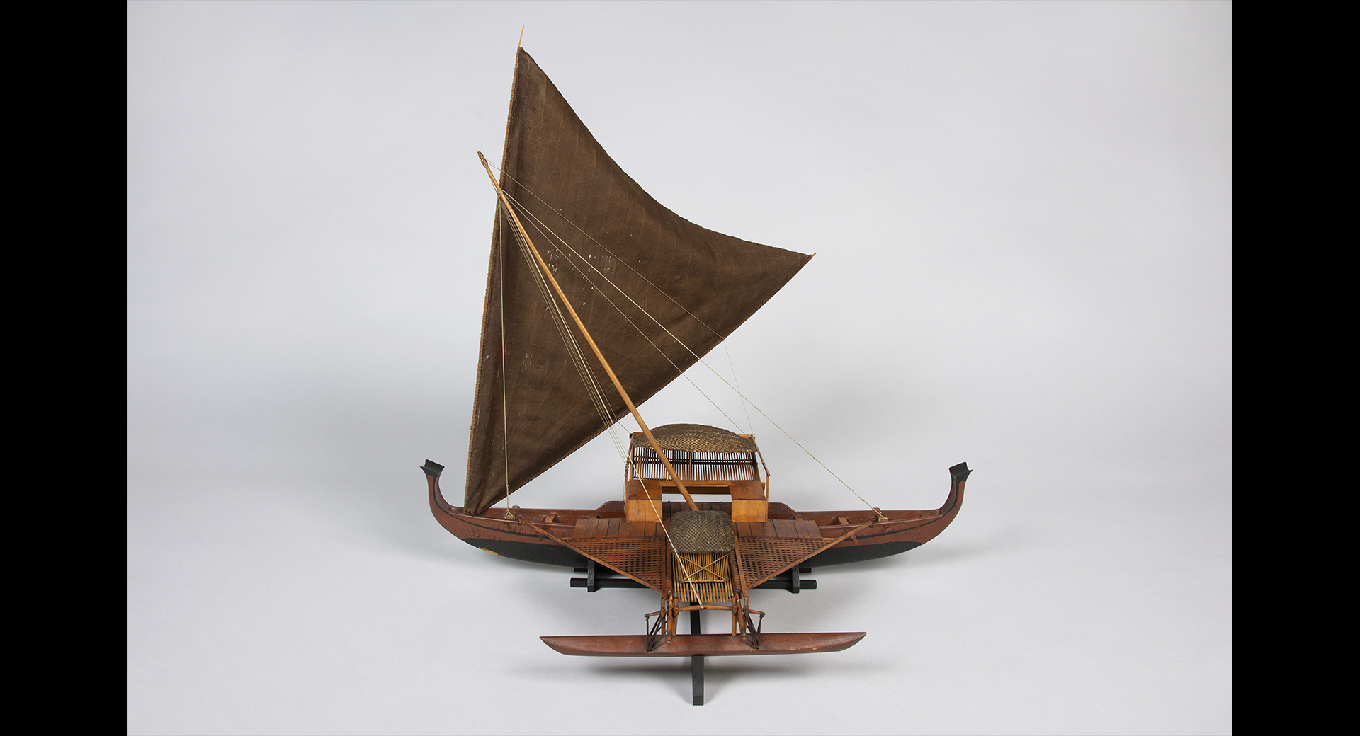
CAROLINE ISLANDS
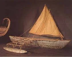
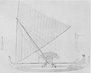
Flying proa from Yap or Santawal atoll.
CAROLINE ISLANDS
Front view of a flying Proa or “popo”
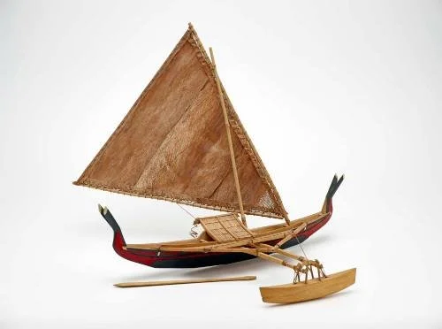
CAROLINE ISLANDS
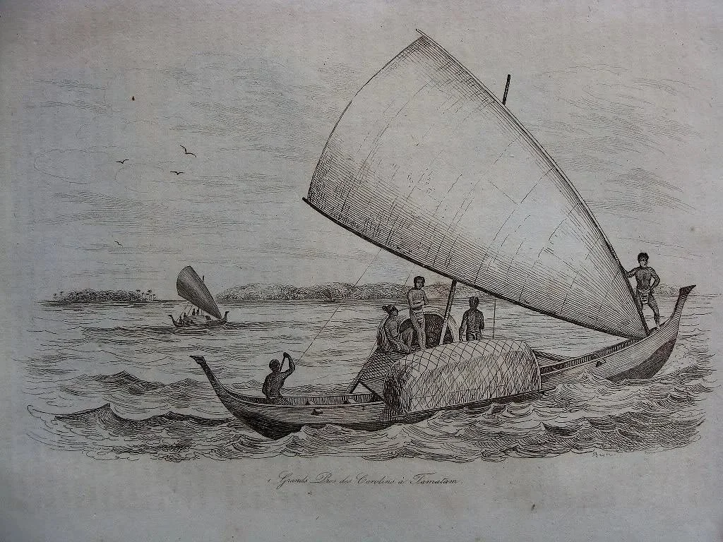
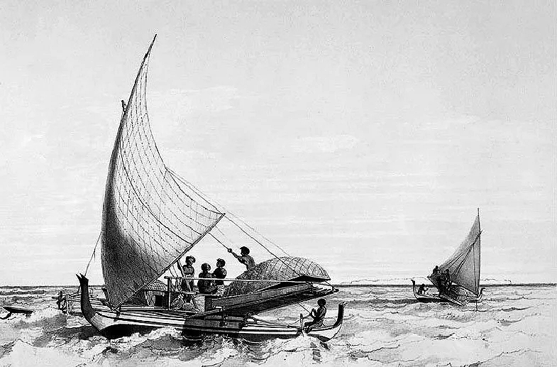
Illustration of fishermen sailing a proa near Tamatam atoll. Drawn by Louis Auguste de Sainson, from Voyage Pittoresque autour du monde by Dumont d’Urville, 1835
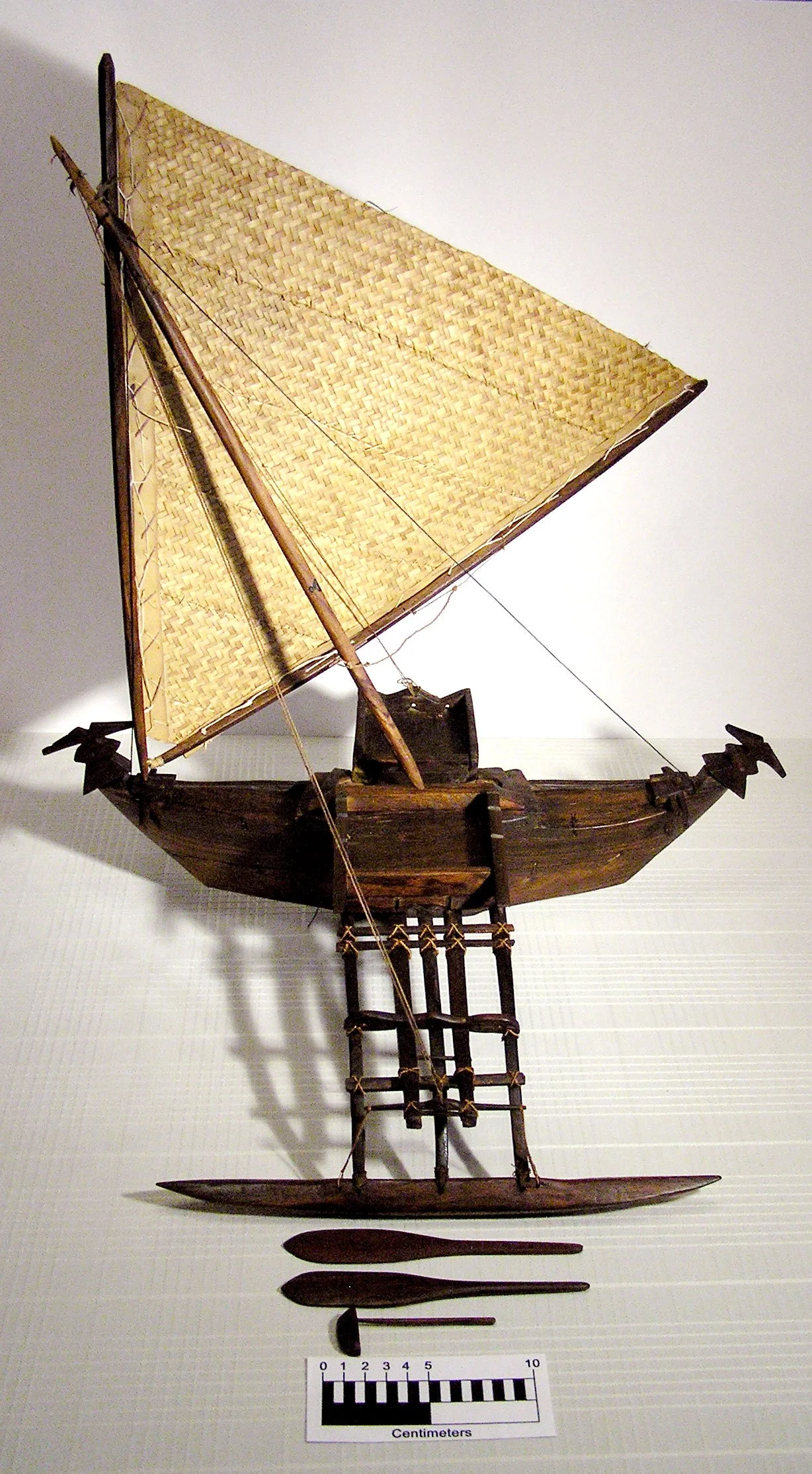
CAROLINE ISLANDS
Voyaging canoe or flying proa; “popo” from the island of Yap and Santawal
CAROLINE ISLANDS
A flying proa of the tiny atoll Satawal by Admiral Francois Edmond Paris. Highly interesting is the blog written about those famous flying proas or “popo”
https://indigenousboats.blogspot.com/search/label/Caroline%20Islands
CAROLINE ISLANDS
Flying proa model , Yap Island
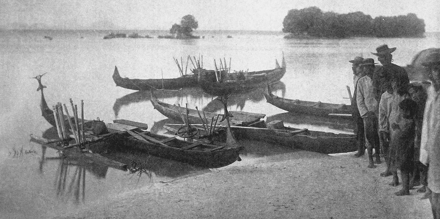
Canoes,_Truk_Lagoon,_Moen_Island_(1899-1900)
War canoes on the island of Weno (formerly Moen Island), part of Truk lagoon. The ornamentations at the extremities of the canoe is supposed to represent Sea swallows. They can be put up or taken down depending on the crew's peaceful or hostile intentions. Putting up the decorations means war; taking them down means peace..
This picture was commercialized as a magic lantern slide in 1899.
CAROLINE ISANDS
A war canoe from Truck lagoon.
CAROLINE ISLANDS
An 1845 copper etching illustrating the 4 Spanish volumes “Historia de Oceania, o quinta parte del Mundo”
CAROLINE ISLANDS
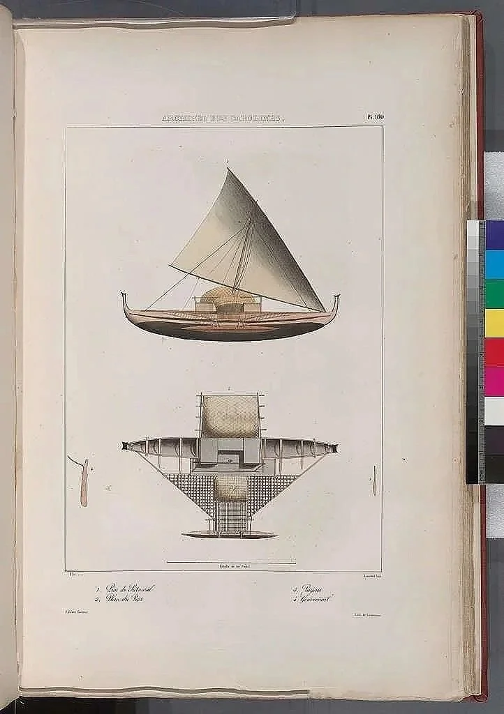
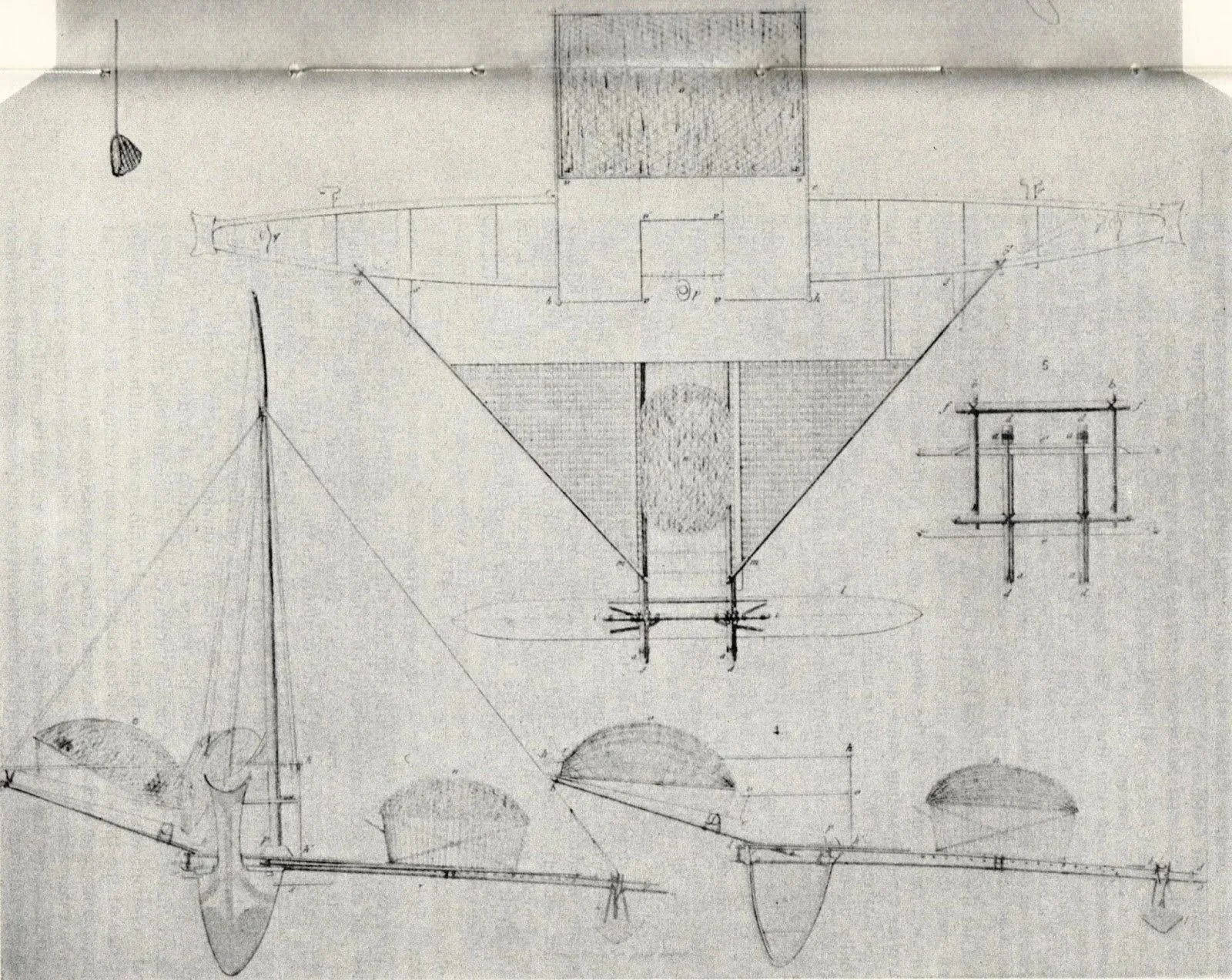
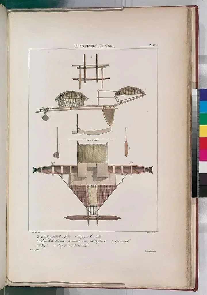
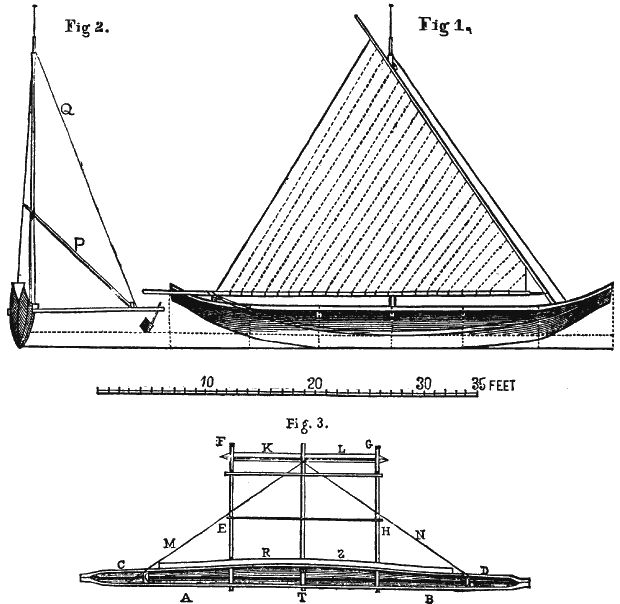
“Popo” or flying proa plan by Admiral Francois-Edmond Paris, 1841
CAROLINE ISLANDS
Another “Flying Proa” or Popo plan by Admiral Francois-Emond Paris, 1841
CAROLINE ISLANDS
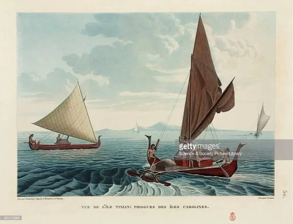
Flying proa sailing towards Tinian atoll in the Mariana Islands (formerly Ladrones Islands)
https://en.wikipedia.org/wiki/Tinian,_Northern_Mariana_Islands
It is interesting to mention the following at this junction :
Trade between the Caroline and Mariana Islands, primarily driven by the Carolinian people, existed before and continued after European contact, though it was interrupted by colonization. Carolinians brought their own handicraft and resources, such as canoes, to Guam in the Marianas to trade for iron and other goods, a pattern that began in the pre-contact era and persisted into the 19th century. Efforts to reestablish these trade routes in the late 18th century, with knowledge passed down through traditional chants, highlight the importance and resilience of these interactions.
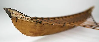
WEST CAROLINE ISLANDS
Side view of a canoe model of the type built on Falalop Island, Yap State.
WEST CAROLINE ISLANDS
CAROLINE ISLANDS
A 19 C. watercolor illustrating some “prao” sailing past Ualan or Ulong Island.
CAROLINE ISLANDS
Voyage de l”Astrolabe, 1826-1829, original hand colored engraving. Picture by Admiral Francois -Edmond Paris
WEST CAROLINE ISLANDS
Koror canoe model, Palau Islands
WEST CAROLINE USLANDS
Front view of a Koror fishing canoe
CAROLINE ISLANDS
Popo canoe model from Yap, Caroline Islands, Federated States of Micronesia
CAROLINE ISLANDS
Wa’a Serik by Herb Kawainui Kane
CAROLINE ISLANDS
Satawal navigators arrives at Okinawa for Expo “75.
MARSHALL ISLANDS ?
Navigational chart.
CAROLINE ISLANDS
Small fishing canoe , Pohnpei or Ponape. The indigenous KA TREE of Pohnpei and Kosrae, not to confound with the Koa tree of Hawaii
Where is Pohnpei ?
https://en.wikipedia.org/wiki/Pohnpei
https://en.wikipedia.org/wiki/Kosrae
The ka tree (Terminalia carolinensis) is a species of tree found in the Micronesian islands of Kosrae and Pohnpei, known for its unique buttressed bases and umbrella-shaped crowns. It is an important timber and canoe-making resource for the local communities and is also used for its edible nuts and medicinal properties. The largest stand of ka trees is located in the Yela Forest on Kosrae, which is protected as a significant freshwater swamp forest and a valuable ecosystem.
CAROLINE ISLANDS
A model outrigger sailing canoe made by Mau Piailug and donated to the Smithsonian in 2000. The sail is woven from strips of Pandanus leaves. Photograph by Chris Urwin.
Who was MAU PIAILUG ?
CAROLINE ISLANDS
WESTERN CAROLINE ISLANDS
A model representative of those built in Koror, Palau Islands
CAROLINE ISLANDS
Nukuoro canoe model
CAROLINE ISLANDS
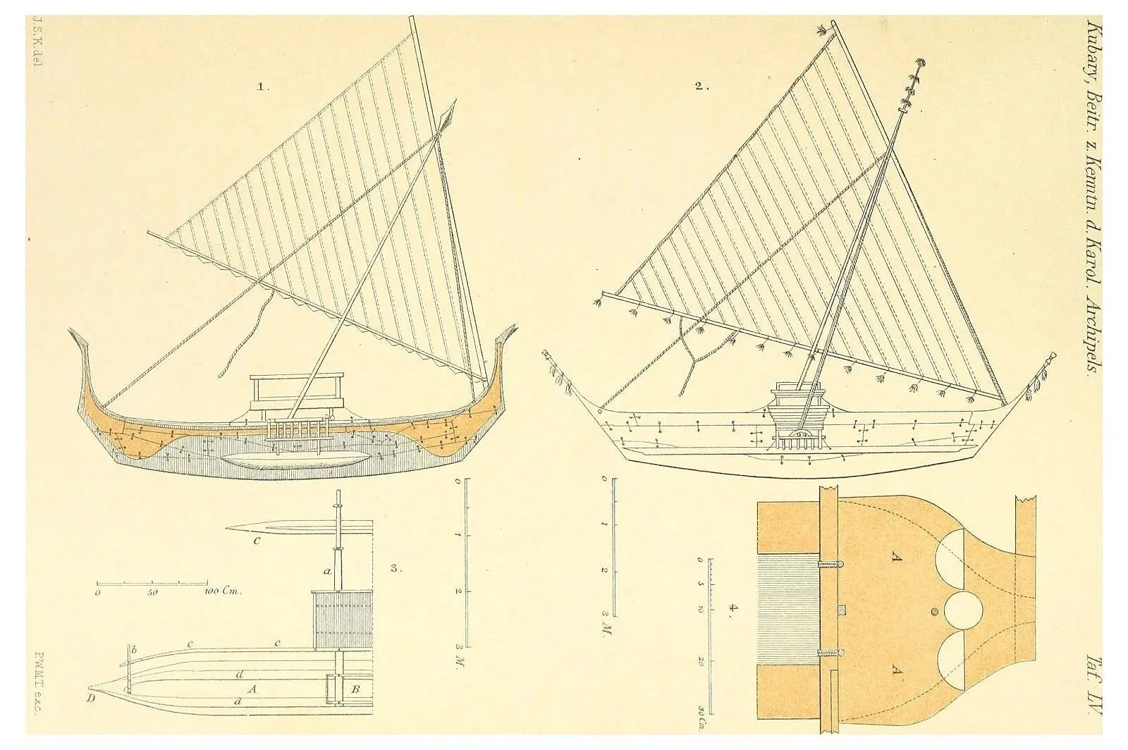
Plan of a flying proa or “popo” drawn is 1895 by the Kubary.
Who was Kubary ?
Nukuoro atoll, 19th C.
Nauruan canoe.
CAROLINE ISLANDS
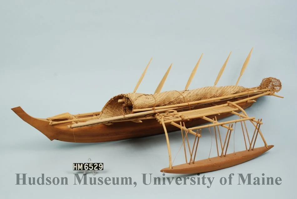
Outrigger canoe model c.1950 -Kapingamarangi Atoll ,Caroline Islands-Emerick Collection/ Hudson Museum
CAROLINE ISLANDS
Truck island canoe model, c. 1950. Emerick Collection/ Hudson Museum
CAROLINE ISLANDS
Model, canoe, Palau
CAROLINE ISLANDS
A tsukupin type canoe model from Yap
Credit: Staatliche Museen zu Berlin, Ethnologisches Museum / Heinz-Günther Malenz
CAROLINE ISLANDS
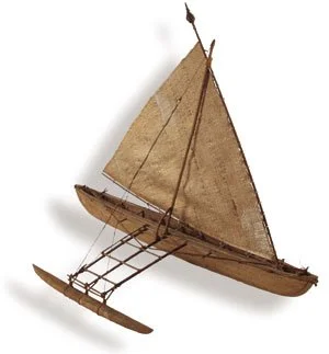
A beautiful proa model from the Satawal archipelago.
CAROLINE ISLANDS
A fishing canoe on Truk island with the name Mog-mog
CAROLINE ISLANDS
Prao de Satawal
CAROLINE ISLANDS
Canoe on mud flat, Port Lottin, Kusale Island (1899-1900), Kusale type canoe
CAROLINE ISLANDS
Port Lottin, Kusale Island. Natives in canoe, (1899-1900) Kusale type canoe
SOUTH WESTERN CAROLINE ISLANDS
The start of a canoe on Sonsorol island
CAROLINE ISLANDS
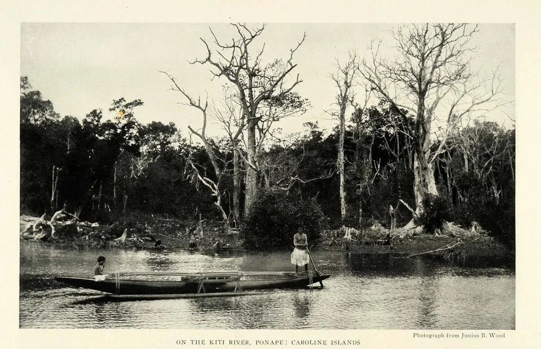
Native and canoe , Ron KIte village, Kite Harbor, Ponape (1899-1900)
MARIANAS ISLANDS -GUAM
Chamoro flying proa
Visit https://www.guampedia.com
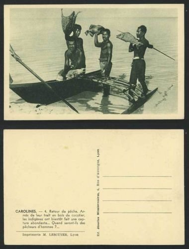
CAROLINE ISLANDS
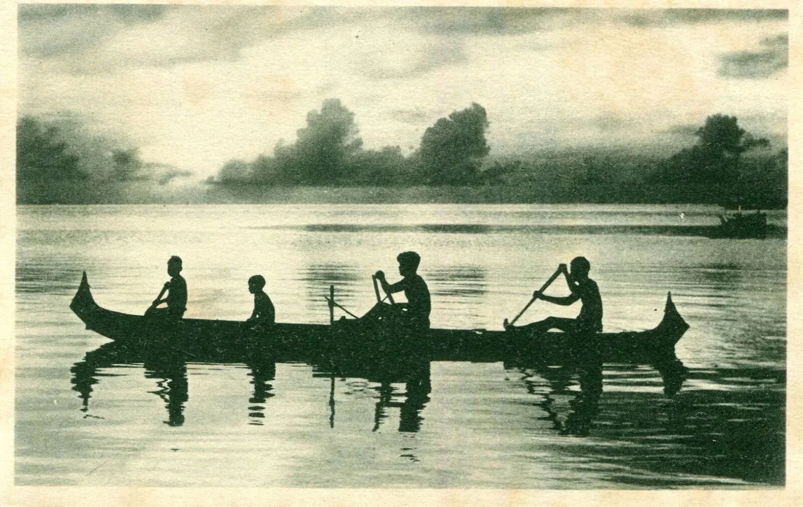
Post card ca.1900 illustrating natives fishing on a proa
MARIANAS ISLANDS
MARIANAS
Tinian Island flying proa model.
https://en.wikipedia.org/wiki/Tinian,_Northern_Mariana_Islands
MARIANAS
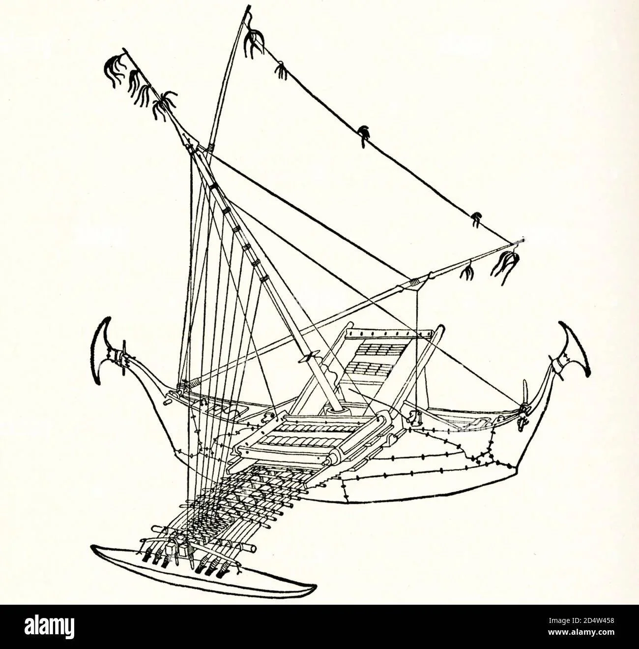
Technical drawing of the Chamorro flying proa or “Sakman”.
MARIANAS ISLANDS
This refers to a type of traditional sailing outrigger canoe, particularly known from the Chamorro people of the Northern Marianas.
Technical drawing of a Flying proa specifically a design by R.M. Munoz.
CAROLINE ISLANDS
Canoe model of the type Waka Siu . Kapingamarangi atoll
MARIANAS
Drawing of the famous Chamorro flying proa or Sakman
MARIANAS- Guam
A Chamorro outrigger model I built many years ago.
MARIANAS ISLANDS
Flying pro model I built some years ago.
MARIANAS-Guam
Windward side of the single outrigger sailing canoe, or flying proa from Guam. Photo courtesy of Keo Santos.
MARIANAS ISLANDS- Guam
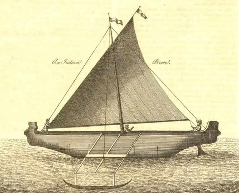
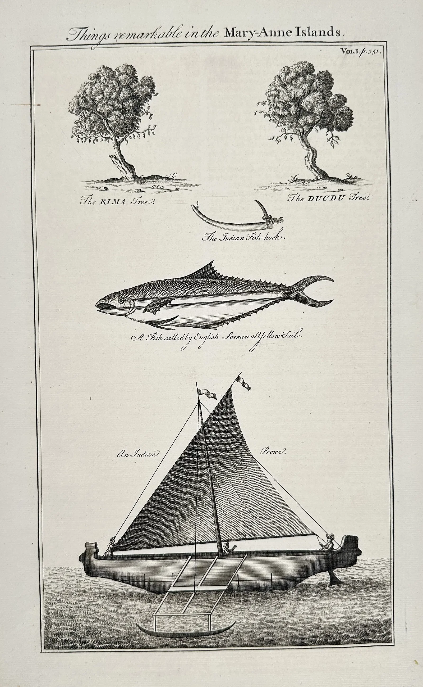
An engraving by John Harris illustrating a breadfruit tree or Rima Tree, a Duku tree, a fish hook and most of all the sketch of a Guam Flying Proa.
John Harris, an English engraver and cartographer active from the late 17th to the mid-18th century, was frequently employed to engrave plates for English publications, particularly those related to travel and exploration, such as the widely popular accounts of William Dampier's voyages.
MARIANAS ISLANDS
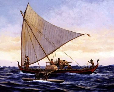
Palau canoe by Herb Kawainui Kane. The painting is based on Augustin Kraemer’s drawing of a Palau rowing canoe in her Volume 3 “Results of the South Seas Expedition”.
MARIANAS ISLANDS
Palau canoe drawing by Augustin Kraemer in Volume 3 of “Results of The South Seas Expedition”. The Painting by Herb Kawainui Kane “Palau Canoe” is base on this drawing.